with the Sheffield History Group yesterday evening. The number of times we walk around a vary familiar place, but see little, until you actually look!
Our starting point is on the Western side of the City Centre. Like many other towns and cities in Britain, Sheffield has moved its centre through the ages. Beginning at the confluence of the Rivers Sheaf and Don, an early mediaeval town grew round the Castle (the site is currently being excavated). Urban life – markets, workshops, dwellings and civic buildings – gradually moved westwards. This movement was accelerated by the growth of industries which were no longer dependent on water power; new reservoirs being created in the western hills; and the growth of suburban housing benefiting from clean air blowing from the West. That process continues today with the development of The Moor and University expansion.
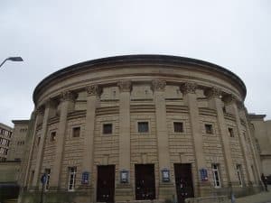
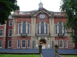
We start on the steps of the City Hall (1928-32, E. Vincent Harris). Before we move off, we catch a sideways glance to the left of Sheffield Town Hall (1897, E. Mountford). This replaced the ‘Old Town Hall’ of 1807-8, north-east of here on Waingate. Here, there is little else to be seen dating from before the 20″ century; Balm Green, containing the well of Barker’s Pool (immediately to our left) is a survivor – valuable in earlier times as a source of water on this higher ground. What is missing is the Albert Hall, a popular venue for entertainments and meetings on the site of John Lewis and destroyed by fire in 1937. To the right on Division St. is Sheffield Water Works Co. building (1867, Flockton and Abbott), now a bar.
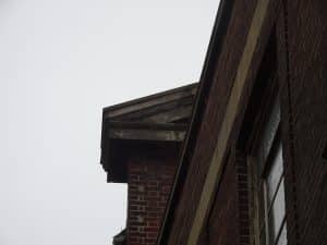
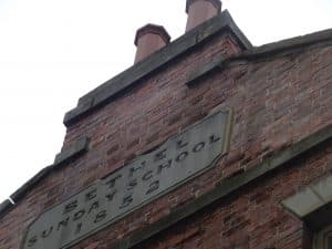
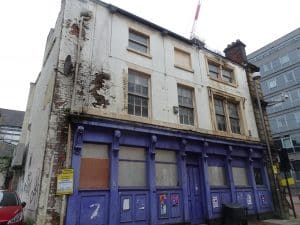
We cross Division St. to the John Lewis side, passing the War Memorial of 1925 (a ‘highly unconventional design’ by C.D. Carus Wilson). John Lewis, originally Cole Brothers, moved here in 1965 from their previous 19th C store at the bottom of Fargate. We walk down the right¬hand side on to Cambridge St., originally called Coal Pit Lane. No. 16-18 is a small coach¬building works of 1878. Below this, Leah’s Yard, containing a variety of ‘Little Mester’s’ workshops has been a contentious and still uncompleted restoration site, regrettably not open to the public. We walk down the narrow Bethel Walk adjacent to the Bethel Sunday School
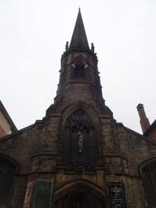
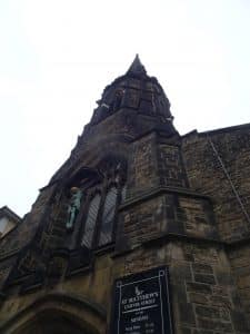
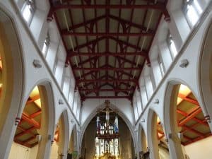
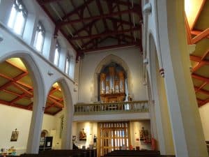
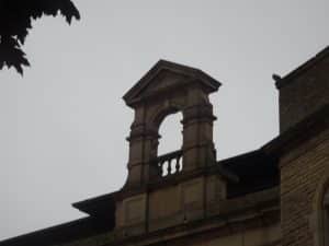
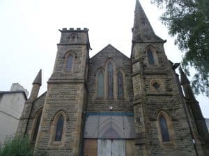
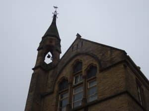
of 1 852, then through an area of ‘car parks’ and dereliction – the result of WW 11 bomb damage and the levelling of poor buildings. Then round to Carver St., and the front door of St. Matthews Church. Justly-regarded as the jewel of this previously slum area of Backfields. It was built in 1855 by the Sheffield architects Flockton and Son as a centre of High Church/Anglo-Catholic worship. We spent some time on the interior furnishings with work by Henry Wilson, J.D. Sedding, H.I. Potter and Henry Longden.
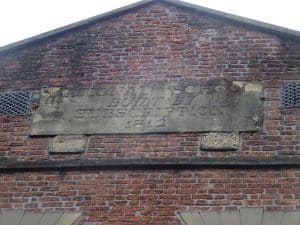
Turning right from St. Matthews along Carver St., we cross Division St. On the right is the National School of 1811. Opposite, the massive Alpha Works of 1900 by Holmes and Watson. At the end of Carver St is the splendid Methodist Chapel of 1804, now a pub.
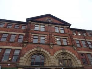
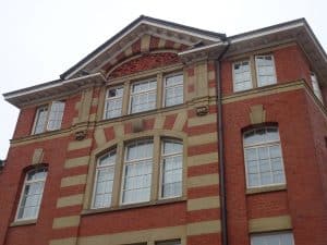
Most of these larger buildings predate the Victorian era, indicating the period when this area became built up. Turning right along Holly Lane we begin to see a later phase of development, the most spectacular being the Educational complex on our right, occupying the large corner site between Leopold St. and West St. – a demonstration of the increased wealth and aspirations of the later 19`h century. It is composed of three sections: the Central Schools of 1876; Firth College of 1879; and the School Board Offices of 1880. We will walk through what is now a hotel and restaurant complex, to Leopold St., then turn left to the junction with Church Street. This corner gives us a good view, both downhill to the valley of the Don, and westward towards Pinfold Street and Trippett Lane along which we now walk.
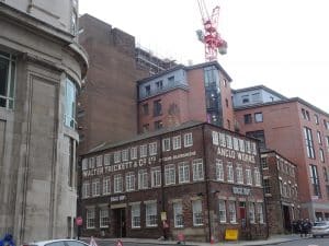
Trippett Lane is an older thoroughfare leading westwards from St. Peters Church (Cathedral)¬still a broad street though mercifully less busy. It was superceded by the construction in 1821 of West Street, the turnpike road to Glossop and Manchester. On the left, the splendid restoration of Anglo Works, occupied for most of the 19`h century by Walter Trickett’s cutlery workshop, followed on the right by the massive furniture warehouse of 1906 for Walsh’s department store, and two traditional pubs, the Grapes and the Dog and Partridge.
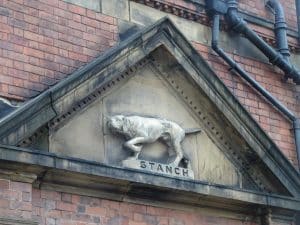
Turning right into Bailey Lane we look down Brook Hill and across to St. Vincent’s Catholic Church- now being converted to secular use and all but invisible behind tower blocks. On the left the file-cutters works of J. and R. Carr with the ‘Stanch’ dog above; to the right workshops. typical of, and ubiquitous in Sheffield’s past – a stark contrast to the backyard of Grunwerg’s.
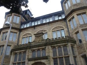
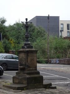
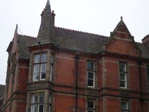
On joining the busy Brook Hill, we look across to 114 Brook Hill, an incongruous residential survival from the early 19th century, with the adjacent overgrown Quaker burial ground. On the cobbled frontage, the remains of an ornate drinking fountain for horses and humans, erected by the Montgomery Sunday Schools (inscription damaged but before 1850). To the left are the earliest buildings of Sheffield University on Mappin St. In 1884 Sir Frederick Mappin founded a technical school in a former Grammar School of 1824. This was demolished and replaced with an impressive brick range of in a Renaissance style by E. Mitchell Gibbs 1902 – 13 (Gibbs was retained by the fledgling University); now the Department of Engineering. It faces the graveyard of St. George’s Church, a Commissioner’s Church (Woodhead and Hurst 1825), now converted to a lecture theatre and student flats.
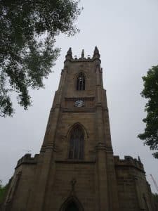
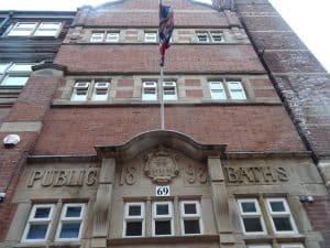
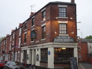
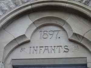
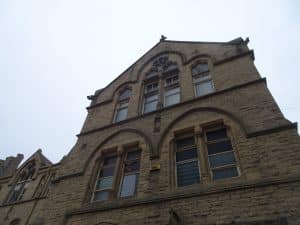
Walking between St. George’s and the new Diamond building, to the right we come to the Jessop building, previously the Women’s Hospital, now the University Music department (J.D. Webster 1878); named after steel magnate and twice Lord Mayor Thomas Jessop (1803 – 1887) Here we turn left into Victoria St., a largely unaltered group of late Regency houses; note the Church of the Nazarene, 1851. Near the corner facing Glossop Road is the imposing Somme Barracks of 1907. We cross the road to the Glossop Road Baths (rebuilt Arthur Nunwick 1908 following the widening of West St). Opposite its west side is the Bath Tavern c.1870, evidently a corner shop in origin. Before turning into Devonshire Green is the impressive Springfield Board School (Innocent and Brown 1875) We return to the City Centre and our starting point.
City Hall